Arizona Faces Heavier Rain Risk as Pacific Moisture System Tracks East
The system is expected to bring the greatest downpour risk to Arizona on Sunday, while coastal tides and weekend rain remain concerns in California.
The main flood concern from the approaching Pacific moisture system is shifting east: Arizona faces the stronger rainfall risk, with the event expected to peak Sunday. California is forecast to avoid a direct hit, though elevated coastal tides and weekend rain could still create local problems across the south of the state.

Flood watches cover central Arizona, including Phoenix, through Friday. The Weather Prediction Center puts the chance of excessive rainfall in parts of Arizona at 15% from Saturday into Sunday. Jennifer Tate, a meteorologist at the center, said, “California could get something, but it is really farther east of there that we are most concerned about.” She added that “the biggest part of the event looks to be Sunday.”
Arizona carries the larger rainfall exposure
The moisture plume is expected to brush southern California before crossing northern Mexico and reaching the U.S. Southwest over the weekend. The forecast points to parts of Mexico’s Baja California experiencing a category three or four atmospheric river event, which would carry heavy rain into Arizona. The Center for Western Weather and Water Extremes says California is expected to miss the system’s direct path.

That distinction matters for the distribution of near-term flood risk. Southern California has a 5% chance of excessive rain over the same Saturday-to-Sunday period. Downtown Los Angeles has its best chance of rain Saturday night, and the county could receive 0.5 to 1.5 inches through the weekend. Those amounts are forecasts, not guarantees; where rain falls and how quickly it accumulates will shape the local effects.
Atmospheric rivers are long bands of moisture that travel across the Pacific. The National Oceanic and Atmospheric Administration describes them as carrying water at a rate comparable to the flow through the mouth of the Mississippi River. Their potential impact depends partly on their strength: the five-category scale classifies category one and two events as potentially beneficial, while events above category three tend to be more destructive.

Coastal tides add a separate concern
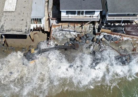
Along the Southern California coast, warnings and advisories are in effect through Friday as northwest winds push tides nearly 2 feet (61 centimeters) above normal around San Diego and Los Angeles. The full moon is contributing to the higher tides, as are Kelvin waves associated with strengthening El Niño conditions.
This coastal exposure is distinct from the rain threat moving toward Arizona. High tides can raise the risk of coastal flooding even when a location is outside the heaviest rainfall zone. The combination of elevated water levels and any local rain could complicate conditions in exposed areas, although the source forecast does not specify which locations will see impacts.

The National Weather Service has urged families to prepare backup plans for annual Halloween trick-or-treat celebrations. That advice reflects the uncertainty around weekend rain in Southern California: the countywide estimate spans 0.5 to 1.5 inches, and the timing is expected to vary by location.
El Niño raises the stakes beyond this weekend
The approaching system arrives as Pacific El Niño strengthens. Such conditions typically bring heavier rain to the southern United States, from California to Florida, increasing the potential for flooding, mudslides and property damage in California. The article says the likelihood remains high that this El Niño could be the strongest in records dating back to 1950, with effects lasting for months. That broader pattern adds a longer-term source of uncertainty, but it does not determine the precise track or rainfall totals of this weekend’s system.
Hawaii faces another near-term concern. Flood watches are in place for almost all of its populated islands, where heavy rain was expected overnight into Thursday. Possible consequences include flash flooding, road closures and landslides.
For communities and businesses, the immediate picture is uneven: Arizona has the higher excessive-rain probability and a Sunday peak, Southern California has a lower but meaningful chance of heavy rain alongside unusually high tides, and Hawaii is preparing for heavy rainfall. The next practical signals are the system’s track and the timing and concentration of rainfall as it moves east.